
Drones World Editor Kartikeya in conversation with Mr. Matt Whitaker, Director of Mobility Innovation Platform at Michigan Central.
Drones World (DW): What specific regulatory, technical, or community hurdles has your ecosystem uniquely solved that others haven’t?
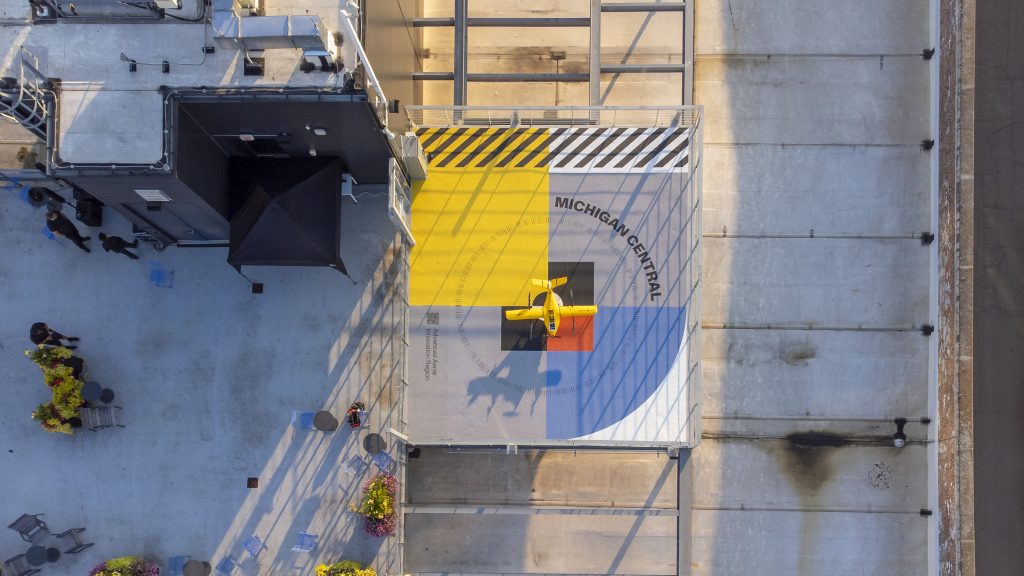
Matt Whitaker (MW): Michigan Central has created a complete, turn-key solution for testing and scaling drone technologies: the Advanced Aerial Innovation Region (AAIR). This platform uniquely blends a 28-square-mile urban testing area with physical labs, digital safety infrastructure, full-spectrum regulatory support, and direct pathways to customers and community. The key differentiator is the ecosystem itself—we bring together startups, Fortune 500 companies, universities, and government into one network. This allows a startup to enter contracts, pilot new tech, and deploy BVLOS rapidly, as AAIR guides them through federal authorization, state coordination, and municipal permitting in one integrated process.
DW: How does Detroit’s industrial legacy provide a tangible advantage for modern drone startups over other tech hubs?
MW: Many testing hubs are in rural or converted airport spaces. AAIR spans a dense mix of commercial, industrial, residential, and retail zones—the perfect real-world environment to prove an aerial system’s practical value. Beyond the airspace, Detroit brings a century of mass manufacturing and complex logistical know-how. Over 1.7 million vehicles roll off local assembly lines annually. We believe the talent and processes behind that scale, when paired with our regulatory support, can be adapted to build a robust aerial ecosystem capable of meeting demand for millions of new drone units per year.
DW: Beyond airspace access, what is the most valuable non-technical resource your platform provides?
MW: We focus on three critical resources: physical infrastructure, virtual integration, and talent.
- Physical: This includes launch pads integrated into our Newlab startup hub, an air traffic operations center, ground-based detect-and-avoid systems, and 18,000 sq. ft. of advanced prototyping labs.
- Virtual: Our partnership with Airspace Link provides a digital platform for real-time airspace risk assessment, traffic management, and operations.
- Talent: Michigan has one of the world’s largest concentrations of automotive engineering talent. We’re bolstering this with targeted workforce programs with universities, creating classroom-to-career pathways in robotics and automation. For example, our CODE313 program has seen graduates as young as 18 become certified pilots for live BVLOS delivery missions.
DW: Which specific startup operating in your ecosystem best demonstrates the “before and after” impact of your model?
MW: Lamarr.AI, an automated building diagnostics provider, is a prime example. By leveraging AAIR’s capabilities, they shifted from visual line-of-sight to BVLOS operations for a pilot with the City of Detroit, scanning municipal buildings citywide. They identified over 460 areas of thermal energy loss, projected to save 22% in HVAC costs. This success in Detroit has directly accelerated Lamarr.AI‘s deployment across eight other states, Canada, the UK, and the UAE, scaling a solution for portfolio-wide energy efficiency.
DW: As the FAA’s Part 108 (BVLOS) looms, how is Detroit’s progress creating a de-facto national blueprint?
MW: While many cities are playing catch-up, Detroit is already operational. AAIR is the complete package—a turnkey solution that will serve as the blueprint for American cities in 2026 as they modernize for Part 108. Our ecosystem will help startups rapidly adapt to the new ruleset and enable businesses to operate at a real-world urban scale. The framework we’re building through commercial and public use cases is creating the playbook to inform and accelerate drone utilization nationwide.
DW: What is your most effective strategy for building crucial public trust and acceptance for urban drone operations?
MW: It’s a dual strategy of data-driven policy and deep community engagement. We share critical real-world data from over 1,000 BVLOS flights with policymakers—providing insights on noise, safety, and airspace management to shape regulation based on facts, not speculation. For the community, we launched a first-of-its-kind Flight Viewer, allowing residents to see what’s flying in AAIR, ensuring transparency. We also link innovation directly to local opportunity through workforce programs, impacting over 3,000 youth and adult learners to date, building trust by showing how this emerging sector creates local careers.
DW: Looking at your portfolio, which application—logistics, public safety, inspection—is maturing fastest and why?
MW: Public safety adoption has been exceptionally compelling and fast-growing, as first responders immediately see the value in rapid, safe aerial insights.
However, looking forward, we segment the commercial market into “data” (sensor-based inspection, mapping) and “delivery.” Evidence from AAIR suggests the data segment will outpace delivery in the near term, unlocked by Part 108 but without the same operational complexities. That said, we’re equally excited by the fantastic progress of partners like blueflite, who are making huge strides in solving those more complicated delivery challenges. Our mission is to enable scale across the entire spectrum.